Interactive Regional Map
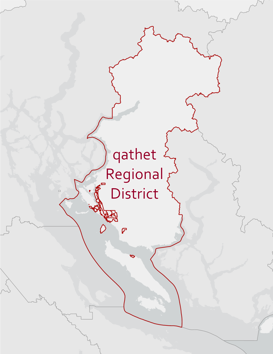
qathet Regional District’s interactive map provides property information such as house numbers and legal descriptions as well as multi-year air photos. This mapping has been compiled for your information and convenience using data derived from a number of different sources with varying levels of accuracy and precision. In October of 2021, qathet Regional District adopted the ParcelMap BC fabric to represent legal lot lines in our mapping. ParcelMap BC is a service provided by the Land Title and Survey Authority of BC. Visit ltsa.ca for more information. To verify legal descriptions or access legal plans, contact BC Land Title and Survey Authority.
Having trouble opening iMap? Enable “cookies” on your browser for this site.
Questions about map layers within the City of Powell River? Contact the City’s Mapping Department at 604-485-8606.
Need help using this mapping? Select the “Help with iMap” link once iMap has loaded. This help link is the small globe icon on the right hand side of the top tool bar. The help page explains the use of all the tools available to you.
Should you find any errors, omissions or discrepancies in the map, please contact our GIS/Survey Technician at 604-485-2260.
New Interactive Map
The qathet Regional District (qRD) is trialing a new online Land Information Map to make local information easier to find and use. The map includes a Consolidated Zoning information layer, a Consolidated Official Community Plan (OCP) Land Use Designation information layer, as well as layers showing Development Permit Areas (DPAs), the Agricultural Land Reserve (ALR), and Potential Hazard Areas. Along with a modern interface, it introduces new tools for exploring and analyzing information while still offering many features similar to iMap. During the transition period, both the new and existing maps will remain available to allow users to get familiar with the new system. The link to this new map is below.